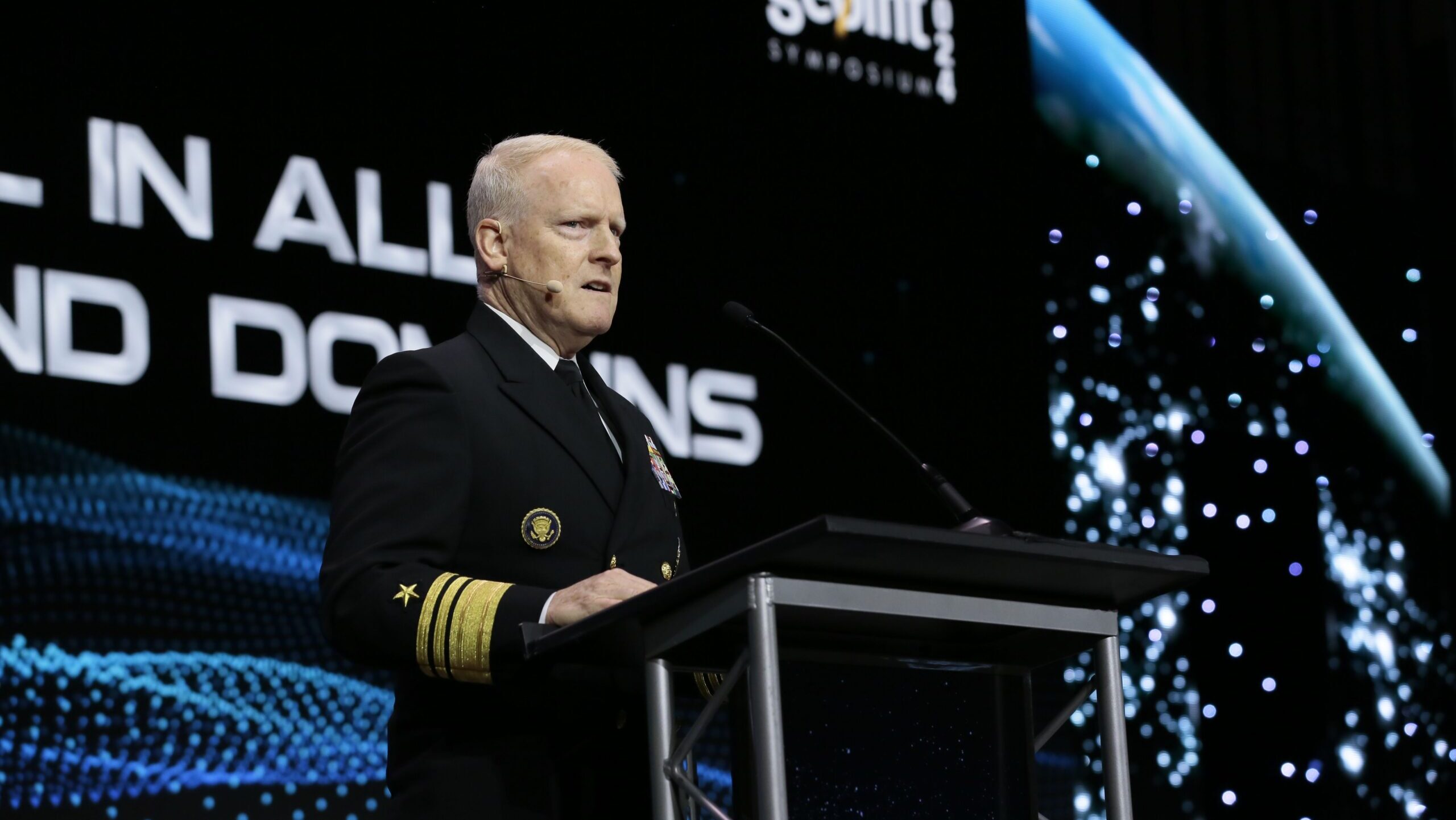
National Geospatial-Intelligence Agency head Vice Admiral Frank Whitworth speaks at the 2024 GEOINT conference. (Courtesy GEOINT)
GEOINT 2024 — Vice Adm. Frank Whitworth, the director of the National Geospatial-Intelligence Agency (NGA), wants to bust some “myths” about his agency — in particular that NGA’s analysts are a speedbump to rapid delivery of critical decision-making intelligence from satellites, both commercial and government, to US military commanders in the field.
In an exclusive interview Monday during the US Geospatial Intelligence Foundation’s annual GEOINT conference in Kissimmee, Fla., Whitworth argued that not only is his agency delivering timely intelligence, surveillance and reconnaissance (ISR) to users, it also performs other critical functions — especially validating the authenticity of incoming sensor data and making sense out of that data.
“I would just also caution, that if someone thinks that just raw data [sent to that] edge node is going to solve everything, I would ask them to put themselves in the position of maybe being that pilot or being that submarine captain, skipper or … the land component commander. Is the image going to help that individual without some level of analysis, fusion, [and] validation?” he told Breaking Defense.
Whitworth’s comments come as NGA has been caught up in a swirling interagency debate, primarily with the Space Force, about respective roles in managing ISR assets and capabilities — a debate has led to questions from some involved about the agency’s continued relevance in the age of more satellites, more sensor data, more automated processing, and the increased pace of the battlefield.
In his GEOINT keynote speech on Monday, Whitworth explained that NGA personnel are actually embedded at US combatant commands around the world and thus “have a deep understanding of operational priorities.” Further, he said, it is a “complete myth” that NGA’s actions and products are “not moving as rapidly as possible” to those needs.
He acknowledged to Breaking Defense that military commanders always want more information, more quickly. However, he said, it is “another myth” that they are dissatisfied with NGA’s performance.
“But if you ask them, ‘Well, are you unhappy with what NGA is providing in the way of dissemination and the way that we do our tasking?’ I don’t think you’re gonna get that many complaints,” Whitworth added. “I know I don’t. My email should be exploding if we’re doing a bad job.”
NGA started its life as the primary mapmaker for the US government, a job that now includes modeling not just topography but all sorts of terrestrial characteristics such as the planet’s magnetic fields. It further serves as the US “GEOINT functional manager,” charged with making sense of incoming sensor data (such as imagery and radar tracks) from all sources and deciding which users get priority access the information gleaned.
NGA’s mission set also includes tasking US spy satellites owned and operated by the National Reconnaissance Office (NRO) to cover priority areas of interest for US government agencies, the president and military commanders. NGA is authorized to buy, and disseminate, analysis from commercial remote sensing satellite operators.
Whitworth — along with NGA’s Director of Capabilities Trey Treadwell and Director of Commercial Operations Devin Brande — told Breaking Defense that in an era of increasing threats from space, the agency’s complex role is more important than ever. This is especially true with regard to validating the authenticity of incoming data, including for training new automated systems for spotting potential threats, the officials said.
“We’ve got some pretty resourceful adversaries and challenges out there who are gonna make at least training data really difficult. And so having wetware available — and I’m talking about, obviously, humans here — to ensure that the training data remains clean and not affected in an age of potential deception I think is very important,” Whitworth said.
Treadwell elaborated that decision-makers need certainty about intelligence, perhaps to a lesser degree in some cases when speedy reaction is of the essence, but with much greater certainty in other cases where the consequences of a mistake are larger. But in both cases, users need to be able to trust what they are seeing and hearing and that is what NGA does with its standard setting for data processing.
“Somebody’s got to put a ‘Good Housekeeping Seal of Approval’ on algorithms,” he said. “You want to make sure that you understand the machines that were used and the techniques and tools that were used [to] give you that level of certainty.”
Commercial ISR And Meeting The Need For Speed
On the question of “immediacy” of user access to commercial ISR, Whitworth pushed back on assertions that NGA’s process causes delays.
“There are some perceptions out there that there’s an interlocutor, that somebody is receiving the commercial data, looking at it and then deciding what to disseminate. It’s not that way. So, all the commercial data goes into G-EDG and then goes out as quickly as possible — meaning the only thing slowing it down … is the pipe,” he said.
G-EDG is the agency’s data lake and computerized delivery system for unclassified, commercial GEOINT first introduced in 2011. Whitworth noted that there are more than 400,000 G-EGD users.
“There are a lot of people who count on G-EGD from a lot of different walks of life,” he said.
Whitworth added that people need to understand there is no possible way for data to move from one place to another in real-time, “because ones and zeros take time to move through a pipe.”
And NGA is already taking action to try to improve that “pipe” via an IT modernization program called Joint Regional Edge Node, or J-REN, he said.
“At its core, it’s an IT construct, but it’s more than that. The idea here is to have a mesh network of mesh networks, so that you don’t have a hub and spoke model, for your ground data especially,” Whitworth explained. “You don’t just have a hub and a bunch of spokes, because if something happens to the hub, the spokes are left wanting. You need to have a mesh that’s constantly replicating and constantly interacting with other meshes. That’s what J-REN will provide, and most importantly, in a way that a disadvantaged user at the far end the edge will still get their data.”
At the moment, NGA is looking to be put J-REN into operations on a rolling basis beginning in late summer or early fall, Treadwell said.
Better With Teamwork
J-RENS will be coupled with NGA’s new Joint Mission Management Center (JMMC), being stood up as a collaborative space for satellite-based ISR collection and decision-making and open to all 18 members of the Intelligence Community, Whitworth told Breaking Defense.
That center — which the agency is funding “out of hide” — is expected to be working, at least in an initial form, by the end of May, he said.
Coupled with J-REN, the JMMC will help the NGA and the IC figure out “how we doing on our requirements versus what’s come in from international sources — which, by the way, is growing — what’s coming in from commercial sources, and what’s coming in from government sources … and to help the process of prioritization,” he said.
JMMC will further serve as a place “where people actually can look each other in the eye and work this tough issue of prioritization. It’s all about at the end of the day, if people might get emotional on this, it’s going to be on priorities.”
In his GEOINT presentation, Whitworth said collaboration is crucial in the space domain. “It’s no place for a stovepipe, or multiple stovepipes. It requires a joint or integrated approach, where we all work together.”
Instead, Whitworth told Breaking Defense, he is a big fan of “teaming” at all levels. “I like the human and machine teaming. I like the interagency teaming. I like the international teaming, and I like the commercial teaming. And that’s, that’s the best way I can approach to anyone who thinks that we can do this without one agency.”
In a roundtable with reporters after his presentation, Whitworth echoed those comments, avoiding any direct confrontation with Space Force officials.
“I don’t fight in public. I just defend in public,” he said.
